Friday, May 28, 2010
Wednesday, May 26, 2010
Douglas creek trip 2 5/24/2010
Friday, May 14, 2010
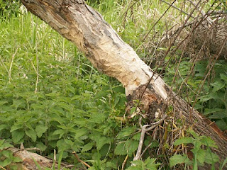
Trees at site six
Thursday, May 13, 2010
Animal sighting
Site Survey May 8, 2010
Today you are going to learn the site survey of Douglas creek at site #6. The stream reach begins at N 47.29.435 W119.54.047. The stream reach ending is N47.29.436 W119.54.022.
First what you are going to learn about site#6 is the riparian zone. The width of the left bank is 0-50ft. the width of the right bank is 50-100ft. Site #6 has a very interesting vegetation. We have moderate conifer trees, no deciduous trees, abundant shrubs and abundant grasses and herbs. The overhead canopy is about 0-25%.
Next you are going to be learning about the channel. The shape and cross section looked like an upside down n. Next is the longitudinal pattern which was meandering. The gradient was very low that day.
Also you are going to learn about the stream bank. The vegetation cover was abundant, the artificial bank protection was 0-25%, and the bank stability had erosion in some areas.
Another thing was the reach habitat. The # of riffles was 2, the # of pools was 3, the percentile of riffles was 10%, and the percentile of pools was 15%. The woody debris was moderate, the organtic debris was abundant.
Now we are going to tell you about the artificial structures. In the stream reach there was liter and garbage, alongside the stream reach there was flood detention with a beaver dam and four wheeler tracks.
Finally was the land use of the stream reach. It is used for recreation.
Subscribe to:
Comments (Atom)


