
Monday, June 6, 2011


Tuesday, May 31, 2011


Tuesday, June 8, 2010
Photo Point 2010


We found that the creek was going twice the speed when we got there for the third time and the vegiation changed by growing a lot.

Macro invertabrates 2010
 On our last trip to Douglas creek we took a test on the macro- invertebrates the graph we made shows that are water is very healthy. Because we found a lot of none tolerant insects and they need to live in so it was a healthy.
Monday, June 7, 2010
conclustion of stream health
The water is good at Douglas creek. Vegetations are improving since are last visit. Our last visit we saw that the vegitation has improved because the first trip the vegitation was reall small and the last trip the vegitation was as taller then me. You would probably see lots of animals like deer and coyotes and other animals like birds would come to eat the bugs. We caught 11 macro-invertebrates and they where all mayflies that that means our stream is good. The dissolved oxygen in the stream is good and the stream has what it needs to support life. Also our stream was the right temperature, 58F. In conclusion our site at Douglas creek is going good.
Friday, May 28, 2010


Wednesday, May 26, 2010
Douglas creek trip 2 5/24/2010
 At the creek there were lots of red ants like these ones. When you sat down to write you would find little red ants crawling up your leg and if they reached your hand they would bite.
Tuesday, May 18, 2010

Friday, May 14, 2010


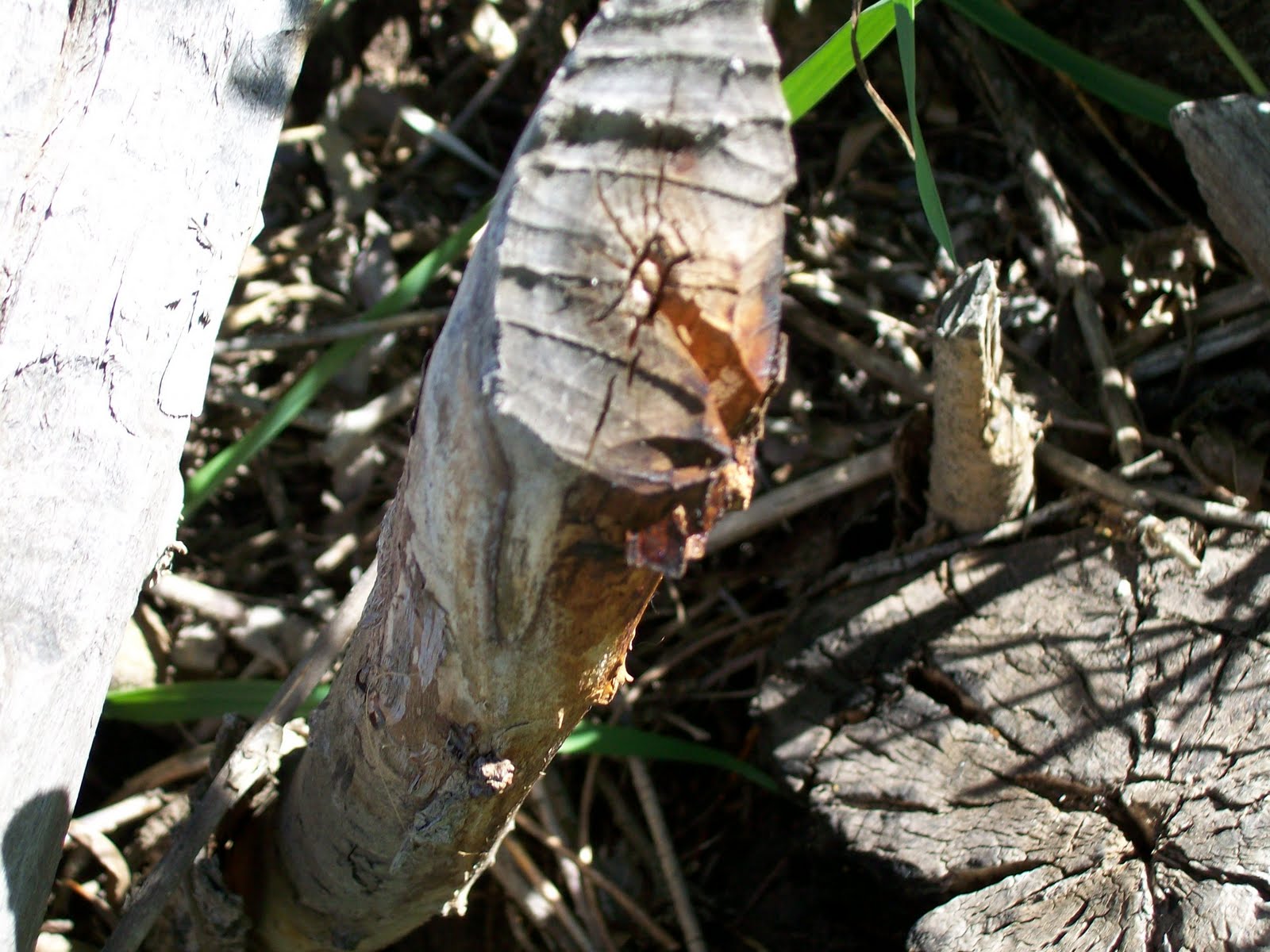
Trees at site six


At the creek there were lots of trees like these ones. You can see the beaver teeth marks we think that the beavers are affecting the trees. In the 2 picture you can see the burnt marks man is also affecting the trees to.
Thursday, May 13, 2010
Animal sighting


At Douglas Creek we had many animal sightings like the ones on the pictures. At the bottom there is a farm of ants they are red ants and they were biting . At the 1 and 2 is beaver teeth marks that are fresh.
Site Survey May 8, 2010
Today you are going to learn the site survey of Douglas creek at site #6. The stream reach begins at N 47.29.435 W119.54.047. The stream reach ending is N47.29.436 W119.54.022.
First what you are going to learn about site#6 is the riparian zone. The width of the left bank is 0-50ft. the width of the right bank is 50-100ft. Site #6 has a very interesting vegetation. We have moderate conifer trees, no deciduous trees, abundant shrubs and abundant grasses and herbs. The overhead canopy is about 0-25%.
Next you are going to be learning about the channel. The shape and cross section looked like an upside down n. Next is the longitudinal pattern which was meandering. The gradient was very low that day.
Also you are going to learn about the stream bank. The vegetation cover was abundant, the artificial bank protection was 0-25%, and the bank stability had erosion in some areas.
Another thing was the reach habitat. The # of riffles was 2, the # of pools was 3, the percentile of riffles was 10%, and the percentile of pools was 15%. The woody debris was moderate, the organtic debris was abundant.
Now we are going to tell you about the artificial structures. In the stream reach there was liter and garbage, alongside the stream reach there was flood detention with a beaver dam and four wheeler tracks.
Finally was the land use of the stream reach. It is used for recreation.
Monday, June 8, 2009
Site Conclusion
The water is good at
Because of the vegetations, you would probably see lots of animals like deer and coyotes. Other animals like birds would come to eat the bugs and bears would come for the fish.
We caught 7 macro-invertebrates and we think that means our stream is good. The dissolved oxygen in the stream is good and the stream has what it needs. Our stream doesn’t have a lot of regular oxygen to kill the fish. Also our stream was the right temperature. In conclusion our site at


Friday, June 5, 2009


Friday, May 15, 2009

Thursday, May 14, 2009

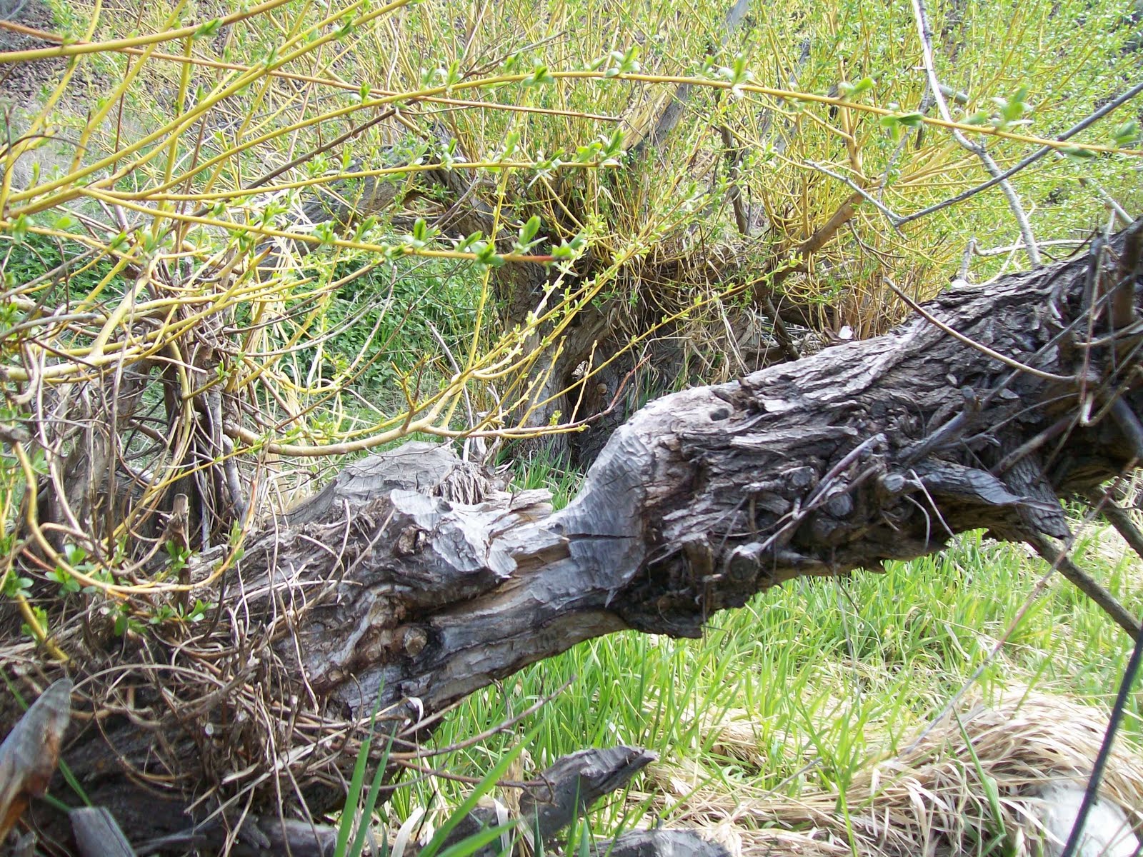
Photo: Animal Evidence

This is a log that has been chewed on by beavers. Can you see the teeth marks?
Tuesday, May 12, 2009

Monday, May 11, 2009
Site Survey Summary 2009
Site Six Survey
Site six is along Douglas Creek. It has a lot of grass and trees nearby. We looked at a section that was 100 feet long from one beaver lodge to another. The latitude is N 47° 29,436’ and the longitude is W 119° 3,630’.
First we looked at the width in the Riparian Zone. The left bank looking downstream was 0-50 inches. The right bank looking downstream was 50-100 inches. We saw deciduous trees and grasses and weeds. The water was clam in the pools. There wasn’t very much shade around. The overhead canopy was only 0-25%.
Second we looked at how the creek was shaped. The creek meandered and was very low less than 3 feet deep with a flat bottom.
Next we looked at the stream banks. The vegetation cover was abundant. The artificial bank protection was 0-25%. The bank was intact.
Fourth we looked at the reach habitat. There were a few riffles and three pools. There were more pools about 70% than riffles about 30%. There was a moderate amount of wood in the water that looked like bamboo. There was a little bit of grass and leaves in the water.
Now we saw some beaver lodges on the sides of the creek. We did not see any other artificial structures in the creek. We saw a road alongside the stream reach.
Finally, we saw some recreation. There were people camping a few sites down stream, about 300-400 feet away.
Site six had a lot of trees around so the beavers could make lodges. It was clean and had calm water. You should see it for yourself.
Subscribe to:
Posts (Atom)